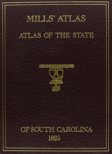
Mills' Atlas: Atlas of the State of South Carolina, 1825

sku: COM9780893081973USED
ACCORDING TO OUR RECORDS THIS PRODUCT IS NOT AVAILABLE NOW
$1,095.48
Shipping from: Canada
Description
This reprint edition of MILLS ATLAS has an especially prepared history and introduction to these maps as well as considerable history about Robert Mills, the man and architect, prepared be Mr. Gene Waddell, formerly Director of the South Carolina Historical Society, Charleston. These maps, originally 23 inches by 29 inches in size, have been conveniently reduced in size to 11inches by 17 inches and folded to fit into an exquisitely gold-stamped simulated leather cover for book shelf or coffee table. The Districts for which maps are included are: Abbeville, Barnwell, Beaufort, Charleston, Chesterfield, Chester, Colleton, Darlington, Edgefield, Fairfield, Greenville, Georgetown, Horry, Kershaw, Lancaster, Laurens, Lexington, Marion, Marlborough, Newberry, Orangeburg, Pendleton, Richland, Spartanburg, Sumter, Union, Williamsburg and York.
Price history chart & currency exchange rate
Customers also viewed

$20.36
Регулируемый гаечный ключ для автомобильных услуг, гаечный ключ 22 мм, 22 мм, инструмент для ремонта автомобилей, регулируемый гаечный ключ, металл высокой твердости
aliexpress.ru
$270.06
YYHC New Product MXM-H310 Series System Motherboard Manufacturer Industrial MXM Motherboard
aliexpress.com
$9.76
Windproof Full Face Cover Hats Keep Warm Ear Protection Winter Goggles Mask Hat Thicken Waterproof Winter Electric Car Hat
aliexpress.com


$4.66
Solid Shade Of Gray Hot Sale Schoolbag Backpack Fashion Bags Solid Color Solid Shade Of Gray Shade Of Grey Grayish Blue Bluish
aliexpress.com
$183.21
Авточехлы Chery Tiggo 1 T11 2005-2020 Toyota Rav 4 2 XA20 1994-2019 черн белый che-kt-t11-, Черный;белый, Chery Tiggo 1 T11 внедорожник 2005-2013 ,Toyota Rav 4 2 XA20 внедорожник 2000-2006
goods.ru
$54.81
Toner Chip Reset for HP W2120A W2121A W2122A W2123A 212A W2120X W2121X W2122X W2123X 212X W2120-A W2121-A W2122-A W2123-A 212-A
aliexpress.com
$0.27
Hand Fan Bubble Fan Multifunctional Plastic 15.5*6.5cm Bubble Machine For Child Fruit Shape Manual Brand New Sturdy
aliexpress.com

$1,487.97
Home Farm Use CattleFeed Making Dsel Engine Straw Ensilage Machine Grass Maize Chopper Dil Chaff CutterGrass Crusher
aliexpress.com

$18.67
Дорожные сумки 900D из ткани Оксфорд, водонепроницаемая Защитная сумка для игровой консоли, регулируемый плечевой ремень большой емкости для ASUS Rog Ally
aliexpress.ru
$5.54
Roasting Pan Tray for Microwave Cooking Baking Roasting Pan Ups Pan Kitchen Bakeware Cooker Silicone
aliexpress.com

$9.29
K3NA Honeycomb Cutting Dies Stencil DIY Scrapbooking Album Card Embossing Crafts Gift
aliexpress.com
$3.46
Умный гигрометр, Термогигрометр, цифровой термометр для сада, Уличный Термометр, тестер температуры и влажности
aliexpress.ru
$19.91
Размера плюс женский купальник из двух предметов, купальник с цветными вставками, купальник-капри, женский купальник
aliexpress.ru
$34.58
Флакон с насосом для лосьона 50 шт./лот-10 мл, прозрачный пластиковый косметический контейнер, насос для клюва, маленькие флаконы для эфирного масла, пустые флаконы для шампуня
aliexpress.ru
$3.35
10 Pcs Leg Protectors for Chairs Floor Protective Case Feet Covers Hook and Loop Furniture Pads
aliexpress.ru
$12.34
New Men Slip-on Snow Boots Winter Warm Cotton Shoes for Men Fashion Anti-slip Ankle Boots Men's Round Toe Plush Outdoor Slippers
aliexpress.com
$13.91
Laptop battery For asus N73 N73F N73G N73J N73JF N73JG N73V N73JN N73JQ N73Q N73S N73SD N73SL N73SN N73SQ N73SV N73SW
aliexpress.com

$366.45
ZC Rattan Ultra-Thin Shoe Cabinet Home Doorway Entrance Corridor Narrow Tilting Entrance Cabinet
aliexpress.com
$20.96
Japanese Samurai Large Mousepad Mouse Pad Gamer Rubber Mouse Mat Gaming Keyboard Pads Speed Desk Accessories Mat 900x400mm
aliexpress.ru —, Белый, Nike Air Force 1")
$298.40
Мужские кроссовки Nike Air Force 1 Mid 07 белые/белые (315123 111) —, Белый, Nike Air Force 1
shopozz.ru
$24.06
Lace White Black Women Seven points Shrug Bolero Lace Wedding Bridal Summer Jacket Elegant Cape
aliexpress.com

$85.18
Shorts Set Women 2023 Spring Autumn Japanese Style Plaid Love Heart Bow Tie Chain Waist-Controlled Top Culottes Two-Piece Sets
aliexpress.com
$36.43
IP67 waterproof 4G 2G GSM Elderly Gps Smart Watch SOS alarm Smartwatch Health Care Wifi Elderly Bracelet senior Disabled People
aliexpress.com
$74.53
i5-7400 i5-7400T i5-7500 i5-7500T i5-7600 i5-7600T i5-7600k i7-6700 i7-6700T i7-6700K i7-7700 i7-7700K i7-7700T CPU
aliexpress.com
$292.88
Global Version POCO X4 GT 5G 128GB/256GB Dimensity 8100 144Hz DynamicSwitch Display 64MP Triple Camera 67W Charging
aliexpress.com
$34.30
Reddish Brown Body Wave Lace Front Wig 13x4 Copper Red Lace Frontal Wigs for Women 180% Density Synthetic Highlight Lace Wig
aliexpress.com
$79.20
2022 luxury designer chunky heels slipper for women sandals classic rivet decoration wear comfortable and beautiful, Black
dhgate.com

$11.94
Пустой брелок, многофункциональные кольца, брелки ручной работы, подвески, деревянные ломтики
aliexpress.ru

$3.93
Клатчи из ПУ кожи, Женский кошелек, клатч для чековой книжки, бумажник для бюджетных документов, Женский кошелек для денег, кошелек, конверты для наличных, Сумка с защелкой
aliexpress.ru
$10.99
Solar Outdoor Light Wind Chime Solar Butterfly Hummingbird Dragonfly Wind Chimes Indoor Color Changing Light Patio Yard Garden
aliexpress.com
$72.40
Electric Burr Coffee Grinder Home Kitchen Adjustable Coffee Bean Grinding Machine For Drip And Percolator Coffee Home 2022 New
aliexpress.com
$31.40
Autumn and Winter New Women's Casual Jacket Solid Color Twist Button Cardigan Sweater Fashion Women's Sweater
aliexpress.com

$19.96
2024 зимняя теплая искусственная Мужская зимняя шапка-бомбер из 100% натурального меха ветрозащитные теплые наушники мужская плоская шапка в русском стиле
aliexpress.ru

$9.50
Kingdom Fishing Hard Lure Jerkbait Wobblers 95mm/125mm/140mm High Quality Floating Minnow 3D Inside Hologram 5 Colors Model 3506
aliexpress.com

