Mapping Techniques Using Drones Alison Course GLOBAL - Digital Certificate

Video Games
sku: 848384
ACCORDING TO OUR RECORDS THIS PRODUCT IS NOT AVAILABLE NOW
1,889.67 руб.
Shipping from: China
Description
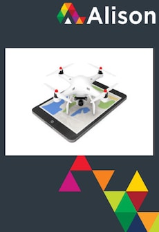
Learn how drone technology is used to create fast and accurate maps. Learn how drones can be used to make sophisticated maps and the technology that is used to do it by studying the course Mapping Techniques Using Drones. The course begins by describing how drones are used to create accurate maps using GPS functionality. You will learn about different types of maps that can be created using a drone and what is involved in planning out a flight for creating a map. The course describes the common aerial views used in mapping and how to achieve good image quality. The course then introduces the process of image overlap and how it is used to get the best results in post-processing. You will learn about the software used to process images on a computer to create maps, and how 3D models are made from hundreds of overlapping still images.Finally, you will learn about drone mapping in practice and how it can be used to help people. You will learn about community mapping, which encourages community members to make spatial representations of their own land. The course also describes cadastral mapping, the spatial representation of cadastre records, and how archaeologists and geologists use drone mapping as part of their studies. This course will be of great interest to anyone who is interested how drones can be used to create sophisticated maps.
Technical Details
| platform: | Alison |
| product_id: | 848384 |
| productid: | 848384 |
Price history chart & currency exchange rate
Customers also viewed

 Band Saw Blades Woodcutting for Cut Hardwood Plastic")
2,596.48 руб.
Dekoly Bandsaw Blade 116 x 1/2 x 4 TPI (for JWBS-14SFX Bandsaws) Band Saw Blades Woodcutting for Cut Hardwood Plastic
aliexpress.com
2,795.50 руб.
Материнская плата для ноутбука Lenovo Ideapad 110-15ISK, BIWP4/P5 LA-D562P, с зеркальным процессором, 4GB-RAM UMA DDR4 100%, протестирована
aliexpress.com
25,288.38 руб.
10 шт., Bluetooth, беспроводной пульт дистанционного управления, держатель безопасности для часов Iwatch, охранная сигнализация Sony Apple Watch, противоугонная сигнализация, подставка для дисплея
aliexpress.com

3,505.43 руб.
2024 весенне-летние эластичные хлопковые повседневные джинсовые брюки-клеш с высокой талией
aliexpress.com

1,339.00 руб.
Женские модные повседневные топы с короткими рукавами и круглым вырезом с принтом S винный
joom.ru
25,087.82 руб.
10A Top Tier Mirror Quality Maxi Shopping Bag Real Leather Lambskin Quilted Tote Luxury Designer Women Black Purse Shoulder Gold Chain Bags faldable Clutch Totes, Carton
dhgate.com
5,825.10 руб.
2020 red metallic 4s basketball shoes for men sneakers 4 trainers orange green purple white rasta man sport shoes us 182y
dhgate.com
1,502.76 руб.
luxury designer jewelry mens bracelets for women fashion bangle buckle stainless steel diamond nail simplicity no bolt driver silv4010062, Black
dhgate.com
10,420.22 руб.
tumi brief pack leather alpha 3 backpack laptop travel osborn roll top logistics flap lid finch BRAVO Search backpack tahoe rivas voyageur mens bag sport 23
dhgate.com
297.39 руб.
Artificial Flower Tea Rose Bouquet Retro Silk Rose Bouquet Hydrangea Peony Vintage Bride Holding Flower Home Wedding Decoration
aliexpress.com
1,035.54 руб.
CkeyiN Sonic Facial Cleansing Brush Massager 3 Colors LED Photon Vibration Deep Cleansing Exfoliating Rechargeable Face Brush50
aliexpress.com
213.51 руб.
New Arrival automotive connector Car Radio Stereo ISO Male Crimp Aerial Connector Converts Bare Wires adapter Antenna
aliexpress.com
177.67 руб.
Charmsmic Square Imitation Pearl Dangle Earrings Korean Japan Style Candy Color Female Geometric Ear Jewelry Decoration 2022
aliexpress.com
71.68 руб.
Fashion Mama Letter Necklace Stainless Steel Pendant Clavicle Chain Choker Personality Jewelry Mother's Day Gift 3 Colors
aliexpress.com
819.74 руб.
Chairs Covers for Dining Room Pack of 4 Pcs Chair Covers Spandex Elastic Chair Covers for Chairs for Kitchen Covers for Home
aliexpress.com
31.26 руб.
M14 Car Auto Polisher Buffing Sanding Angle Grinder Hook Loop Backing Pad Discs
aliexpress.com
1,402.33 руб.
New Women Sandals Summer Fashion Peep Toe Flip Flops Non-slip Flat Sandals Woman Sandalia Feminina Shoes Plus Size 42
aliexpress.com
1,167.46 руб.
Fringed Bikini Blouse Sexy Beach Skirt Corset Women's Beachwear 2021 Summer Printed Swimsuit Blouse Long Shirt New
aliexpress.com
559.71 руб.
Original design lotus Thai silver retro opening adjustable ring Chinese palace bohemian charm women's brand jewelry
aliexpress.com
104.47 руб.
CN 3" Hair Bows for Girls Summer Fruit Printed Glitter Hairgrips Hair Clips Handmade Barrettes for Kids Hair Accessories
aliexpress.com
433.13 руб.
Зубная щетка Barreled Macaron 8, мягкая щетина, повседневные принадлежности, зубная щетка для взрослых
aliexpress.com
16,792.07 руб.
2022luxury france mens down et letter monclair knitted women parkas panel casual coats bomber ets digners men s clothing 001size1-6, Black
dhgate.com GP ORK3804661")


,, Белый")
237.92 руб.
Туалетная бумага премиум-класса Sanft&Sicher, 4-слойная (10 шт. x 180 листов),, Белый
prom.ua 5-6Y - 116 см - чорний")
279.00 руб.
Однотонні трикотажні шортики для дівчинки Джордж (поштучно) 5-6Y - 116 см - чорний
prom.ua
133.51 руб.
Шампунь для волос Орхидея и миндальное молочко блеск и восстановление Basic Care Витекс
prom.ua

