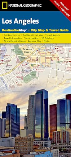
Los Angeles Map (National Geographic Destination City Map)


sku: COM9781597750929NEW
ACCORDING TO OUR RECORDS THIS PRODUCT IS NOT AVAILABLE NOW
$14.67
Shipping from: Canada
Description
· Waterproof · Tear-Resistant · Travel MapBusiness and leisure travelers alike will find National Geographic's City Destination map of Los Angeles is an invaluable tool for exploring this diverse global city. A unique combination of city map and travel guide, this is the ultimate travel companion.The front side includes inset maps of Westside, Long Beach and Anaheim along with a regional map and diagrams of Los Angeles (LAX) and John Wayne Airports. Provided also are general information about the city and surrounding areas, descriptions of popular points of interest and an overview of public transit system. The reverse side features the main map of the entire city from the Santa Monica Mountains to Chino Hills along with an inset map of the downtown area. The easy to read street map shows road designations for freeways, toll roads, main streets, secondary roads and one way streets. Pinpointed are hundreds of points of interest, including subway and train stations, hotels, theaters, churches, notable buildings and parks. A user friendly index of cities and towns, neighborhoods, roads and streets, hotels and points of interest will help you find your destination and plan your route quickly and efficiently.Every Destination Map is printed on durable synthetic paper, making them waterproof, tear-resistant and tough — capable of withstanding the rigors of any kind of travel.Map Scale = 1:204,000Sheet Size = 24.75" x 17.75"Folded Size = 4" x 8.75"
Price history chart & currency exchange rate
Customers also viewed

$1.11
royal stainless steel gold plated cutlery flatware, luxury vintage golden set wedding gold cutlery for hotel restaurant
alibaba.com
$83.56
Обои Hygge, 77 Colors C1 03 Флизелин (1*10,05) Бежевый/Коричневый, Однотонные
santehnika-tut.ru
$3.27
Charging Plug Storage Box Travel Adapter Keychain Jewelry Container Plastic Secret Can Safe Portable Hiding Containers
aliexpress.com
$5.69
Fashion Mens Sexy Base Layer Gym Sports Pouch Pants Leggings Hombre Fitness Workout Breathable Bottoms Underwear
aliexpress.com
$29.55
40Pcs Canvas Zipper Bag Pencil Case Cosmetic Bag Blank Bag DIY Craft Bag Cosmetic Bag Cosmetic Bag DIY Craft School
aliexpress.com
$29.58
USDEU для IIV женская фетровая сумка с дизайном подмышек, роскошная сумка-тоут, модная женская сумка под полумесяцем, маленькая квадратная сумка
aliexpress.com
$59.97
48V 9000mAh Car Water-Gun Wireless Portable High Pressure Car Washing Machine Lithium Battery Charging Car Cleaner Spray Washer
aliexpress.com
$288.81
Seesa 100L Tank 1.5M Boom Rechargeable Battery Powered Atv Sprayer Tractor Mounted For Agriculture
aliexpress.com
$42.41
Ethereal MD 2023, осенний новый стиль, женское повседневное черное трикотажное платье в стиле старых денег с воротником-молнией
aliexpress.ru
$11.61
Африканское платье, комплект одежды для женщин, куртка с рукавом 3/4, топ и платье, костюм, осенняя Новая мода с принтом, офисные африканские наряды для женщин
aliexpress.ru
$167.52
Детская коляска с высокой посадкой, легкая дорожная коляска, двухстороннее сиденье для новорожденных, складная четырехколесная амортизирующая коляска
aliexpress.ru
$2.02
Крючки для хранения одежды, невидимые прочные металлические дверные крючки, металлические крючки без перфорации
aliexpress.ru
$41.49
Мотоциклетный карбюратор Hensim HS400 Jianshe JS400 Mountain Lion ATV для бака 400 Scout 400U
aliexpress.ru
$7.65
Toys Gimmick Props with User Manual Magia Puzzle Beginners Magic Kit Simple Magic Prop Magic Set For Kids Magic Tricks Set
aliexpress.com
$25.76
Women Suit sexy Tights Costume full Bodysuit Spandex Suit open eye mouth and Removable hood for kids men
aliexpress.com
$42.34
Funny Electronic Singing Plastic Fish Battery Powered Robot Toy Simulation Fishes Novelty Spoof Toys Halloween Decorating Play
aliexpress.com
$11.22
2019 Baby Summer Clothing Toddler Kid Baby Girl Stripe Dress Sleeveless Button Dress Casual Sash Clothes Set 2-7T
dhgate.com
$39.00
HKUCO For Racing Jacket-Asian Fit Vented Sunglasses Replacement Polarized Lenses 2 Pairs - Gold & Transition Photochromic
aliexpress.com
$38.86
coat winter Women's women's overcoat women's robe women's overcoat women's overcoat women's overcoat women's robe slogan over
aliexpress.com
$89.38
Brand New Groomsmen Camo Groom Tuxedos Shawl Notch Lapel Men Suits Wedding Best Man Blazer ( Jacket+Pants+Vest + Tie) C318
aliexpress.com
$36.29
Легкий складной стол для кемпинга, портативный, из алюминия, складной обеденный стол для дома и улицы
aliexpress.ru
$35.92
hef jewelry original butterfly clavicle chain female ins fresh simple pendant necklace 925 sterling silver
dhgate.com
$23.39
spring summer cotton linen women capris solid elastic waist harem trousers soft thin female ladys s xxl, Black;white
dhgate.com
$8.77
Kids Room Wall Stickers Dream Jurassic Cartoon Kindergarten Culture Wall Layout Wallpaper Posters Small Pattern Prints Wall Art
aliexpress.com
$17.02
Car Automobile Flannel Cushion Front Trunk Cushion Storage Box Dust Pad Protection Pad for Tesla Model 3
aliexpress.com


