London Pocket Map New ed

sku: COM9780008370015NEW
ACCORDING TO OUR RECORDS THIS PRODUCT IS NOT AVAILABLE NOW
$4.08
Shipping from: Canada
Description
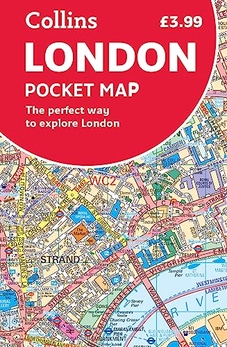
Handy little full color Collins map of central London with a high level of detail. From Regent’s Park in the north to Kennington in the south, and Kensington Gardens in the west to Tower Bridge in the east at a scale of 1:12,500 (5 inches to 1 mile). Maps of West End shopping and theaters are also included. Includes: Detailed central area map, theaters and cinemas map, shopping map, underground map, and the latest congestion zone boundary.
Price history chart & currency exchange rate
Customers also viewed


$25.25
Fashion Watch Classic Design Leisure Brand Quartz Watch Men's Rubber Band Business Men's Waterproof Clock Reloj Hombre
aliexpress.com
$2.26
Motocross Bike Cycling Bandana Neck Cover Printed Ready To Race Mask Scarf Warm Headwear Fishing Unisex Adult Winter
aliexpress.com
$5.86
9 Pcs Saxophone Accessories: 8Pcs Alto/Tenor Mouthpiece Patches Pads 0.8Mm & 1 Pcs Neck Strap With Snap Hook
aliexpress.com
$5.77
Женские новые кроссовки, сетчатая спортивная обувь, дышащая Спортивная обувь для бега, супер яркость и удобство
aliexpress.com
$3.89
Мужские ботинки 2023, Тактические Военные боевые ботинки, уличная зимняя обувь для походов, мужские ботильоны для пустыни с нескользящей подошвой
aliexpress.com
$184.01
NEW Patio Furniture & Accessories›Patio Seating›Benches Safavieh Outdoor Collection Brisbane Grey Storage Bench
aliexpress.com
$40.21
2023 Winter New Black and White Plaid Coat Long Grain Fleece Large Polo Neck for Warm Casual Versatile Loose Wool Coat Commuting
aliexpress.com
$4.90
Beach Nature 3D Harajuku Print Summer New In Fashion Trend Men And Women Camisetas Casual Round Neck Short Sleeve T-shirts Top
aliexpress.com

$134.31
Night Vision Telescope 1080P 2.7 Inch Screen Head-mounted Built-in Battery Rechargeable Infrared Hunting Camping Equipment
aliexpress.com
$0.66
Golden Ginseng Essences Polypeptide Anti-wrinkle Face Serum Fade Fine Lines Hyaluronic Acid Moisturizing Facial Skin Care 100ml
aliexpress.com
$34.64
Car Accessories Parts 89°C Thermostat For RENAULT Megane Clio Station Laguna Fenglang Scenic Thermostat Cover 8200700092
aliexpress.com
$10.10
Овальная тарелка из нержавеющей стали для приправ, блюдо для соуса, тарелка для закусок, кухонная посуда, аксессуары для ужина, 2 шт.
aliexpress.com
$28.65
Pai Suanbao Pigeon Racing Pigeon Homing Pigeon Magic Treasure Competition Conditioning Nutrition Supplement Can Relieve Fatigue
aliexpress.com
$3.31
Подставка для демонстрации ожерелья, деревянный Органайзер, держатель для ювелирных изделий, браслетов, витрина
aliexpress.com
$7.76
Christmas Pine Tree Ornament Prevent Breakage Christmas Pine Tree Decor Reusable Charming Carefully Crafted for Tabletop
aliexpress.com
$3.31
Acrylic Sewing Patchwork Ruler Squedge 22.5°/45° Sewing Template Ruler Patchwork Quilting Ruler DIY Sewing Stencil Tool
aliexpress.com
$3.07
Невидимый портативный держатель для телефона на клейкой основе Подставка для планшета ноутбука Складная подставка для быстрого отведения тепла для мобильного телефона Iphone Xiaomi
aliexpress.ru
$37.15
Rain Boots Kids Rubber Shoes for Women Waterproof Painted Cartoon Doll Rubber Water Shoe Large Size Shoes for Women Rainboots
aliexpress.com

$14.35
bluetooth Золото, спортивный наушник bluetooth наушник bluetooth Наушники наушники гарнитура гарнитуры
jd.ru

$4.98
Милая коробка для сока, коробка для молока, еда, красочная художественная живопись, плакаты на скандинавскую тему и принты, настенная картина для гостиной
joom.ru
$18.41
горилла тег-горилла тег обезьяна с днем рождения-горилла бирка с днем рождения Кепка Бейсболка гольф Мужская шляпа Женская
joom.ru

$27.04
2023 Y2K Spring and autumn clothes loose casual fake two piece sweater women oversize new stitching shirt top long sleeved
aliexpress.com

$10.87
Universal Mini Electronic Brake Fluid Liquid Tester Pen 5 LEDs oisture Water Tool Test-Calibrated Pen
aliexpress.com
$320.00
Alexzendra Gray Mermaid Formal Evening Dress with Shawl 2019 Full Beads Prom Dresses Plus Size Party Dresses vestido de noche
aliexpress.com
$84.55
2019 Elegant Sequin Evening Dress woman formal Long Women Mermaid Prom Dresses Cap Sleeve Scoop Neckline Party Dresses
aliexpress.com


$19.00
8.5 Inch 10.5 Inch Color Screen LCD Writing Tablet Digital Drawing Tablet Portable Tablet Ultrathin Electronic Writing Board
gearbest.com

$2.34
UV Protection Arm Cover Sleeves Tattoo Printed High Elastic Arm Sleeve Temporary Tattoo for Men Women Fake Tattoo Arm Sleeves
aliexpress.com
$15.55
Popular Style Tennis Shoes For Men Lace Up Sneakers Breathable Mesh Outdoor Sport Shoes Men Athletic Footwear Tenis Masculino
aliexpress.com
$1.65
2019 Newest Hot Womens Ladies Solid Leather Satchel Cross Body Tote Bag Messenger Handbag Gold Chain Shoulder Bag
aliexpress.com
$14.24
Road Bike Seat Bicicleta Original GUB 1150 Gel Comfort MTB Mountain Bicycle Saddle Bike Seat Cycling Saddle Seat Cushion
aliexpress.com
$3.53
30 Grids Bra Underwear Socks Socks Storage Organizer Box Non-woven Fabrics Foldable Large Capacity Bedroom Box Closet Wardrobe
aliexpress.com


