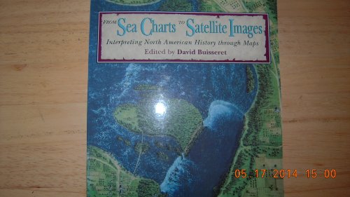
From Sea Charts to Satellite Images: Interpreting North American History Through Maps
Description
A manual on how to use maps in teaching that includes a history of American mapping. Commentaries are accompanied by stimulating new ideas, for instance on how to use bird's-eye views and country atlases in the classroom, and there are didactic discussions on maps showing the walking city and the impact of the street car.
Price history chart & currency exchange rate
Customers also viewed

$389.02
Кроссовки унисекс New Balance 576 Made in England Veg Tan Whisper-White Turtledove OU576VT 42
joom.ru
$222.08
12-дюймовая Вибрирующая полировальная машина для очистки поверхностных пятен, шлифовальная машина для самостоятельного изготовления ювелирных изделий, инструмент для удаления загрязнений
aliexpress.ru
$1.45
Hardware Kit Hubs 2pcs E-Clips 4pcs Thrust Washers Front Wheel Bushing Tool Accessories Hub Cap Retainer Washers
aliexpress.com
$82.11
modern floor lamp wood art solid led floor lamps wood cloth art lampshade living room bedroom bedside lighting home decor floor
aliexpress.com
$90.20
Автомобильный Компрессор переменного тока для Chana Benni/Benben 1.0L Changan Benni оригинальный компрессор кондиционера
aliexpress.ru
$14.89
Высококачественная силиконовая сумка для мужчин и женщин старшего возраста, коллекционный набор, дышащий для мочи и недержания мочи
aliexpress.ru
$6.35
Пенал школьный пластиковый блогер Влад Бумага А4 (blogger Vlad A4) (34408-2622-4) Розовый
rozetka.com.ua
$67.31
Бокс Спорт Умная Музыка Боксерский Аппарат Bluetooth Боксерская Подушка Мешок с Песком С Светодиодной Подсветкой Домашний
joom.ru
$25.65
modish style basketball shoes 4 4s men women designer pine green military messy room pn dust seafoam flight nostalgia thunder lightning spor
dhgate.com
$41.81
new led light bar spot flood combo work light worklight 9-24v 4wd 12 volt led work lights for off road vehicle suv car trucks
dhgate.com
$75.44
new autumn winter women boots solid lace-up european ladies shoes cow leather fashion boots ing, Black
dhgate.com
$25.92
trapstar undersea blue printed tshirt women summer breathable casual short sleeve street hip hop tee clothing soft 220629, White;black
dhgate.com
$26.16
elegant off shoulder v neck autumn sweaters vintage sequin patchwork knitted sweater casual women long sleeve pullover 201222, White;black
dhgate.com
$102.55
Womens M&S Collection Leather Studded Buckle Platform Clogs - Black, Black
marksandspencer.com
$299.80
m81267 micro metiss cross body flap bag designer handbags totes wallets purses card holders satchels
dhgate.com
$178.27
Shoulder Bags 2023 Designer Ladies Handbag Messenger Bags Style Outdoor Casual Fashion Presbyopic One Shoulder Suitable For All Kinds Of Top Quality, Brown flower
dhgate.com
$9.75
Women Sweater 2021 V-Neck Casual Open Stitch Thick Loose-fitting Autumn Winter Twist Cardigan Solid Medium Length Sweater
aliexpress.com
$18.67
Инструменты, лазерная резка, настенные часы Longplay, декоративные настенные часы для крепления гаража и автомобиля, современный подвесной дек...
aliexpress.ru
$10.87
2020 New 925 Sterling Silver Pan necklace Silver Lucky Clover Pan necklace For Women Wedding Party Gift Fashion Jewelry
aliexpress.com
$43.87
Worx WX240 4V USB Mini Electric Отвертка Держатель шланга DIY Болт Драйвер Инструмент Ручка с 26 битами
banggood.com
$55.38
Пляжный стул, полиэстеровое волокно, портативный, высокопрочный, с регулируемым подголовником
aliexpress.ru
$8.42
Quilted coral velvet carpet hanging basket Yoga tent mat bedroom living room circular carpet floor mat
aliexpress.com
$98.45
Wuli Nordic Bedside Table Japanese-style Bedroom Furniture Double Drawer Locker White Oak Bedside Cabinet Nightstands Solid Wood
aliexpress.com
$1.61
Hot Colorful Christmas Simulation Glitter leaf Artificial Leaves Christmas Tree Decoration Party Ornaments Christmas Decoration
aliexpress.com
$5.60
Outdoor Camping Lamp Pole Holder Foldable Aluminum Alloy Portable Hiking Travel Picnic Hanging Light Bracket Fixing Stand
aliexpress.com
$112.00
woolen coat women's mid-length korean style autumn and winter clothing small slim woolen coat
fordeal.com
$10.80
Циклон промышленный пылесборник Sn50 конуса промышленная пылеуловитель Циклон порошок мешочный пылевой фильтр пылесборник
aliexpress.ru
$10.49
Легкие рабочие ботинки со стальным носком, мужские противоударные кроссовки, защитная обувь, повседневная мужская обувь
aliexpress.ru


