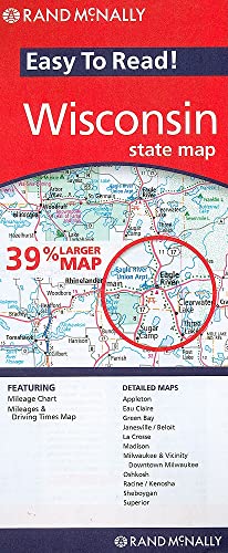
Easy To Read: Wisconsin State Map (Rand McNally Easy to Read!)

sku: COM9780528882128NEW
ACCORDING TO OUR RECORDS THIS PRODUCT IS NOT AVAILABLE NOW
$20.03
Shipping from: Canada
Description
Rand McNally's Easy To Read State Folded Map is a must-have for anyone traveling in and around Wisconsin, offering unbeatable accuracy and reliability at a great price. Our trusted cartography shows all Interstate, U.S., state, and county highways, along with clearly indicated parks, points of interest, airports, county boundaries, and streets. The easy-to-use legend and detailed index make for quick and easy location of destinations. You'll see why Rand McNally folded maps have been the trusted standard for years. Regularly updated, full-color maps 39% larger map with a bigger type size than the Rand McNally Folded Map Clearly labeled Interstate, U.S., state, and county highways Indications of parks, points of interest, airports, county boundaries, and more Mileage and driving times map Detailed index Convenient folded sizeCoverage AreaDetailed maps of: Appleton, Eau Claire, Green Bay, Janesville/Beloit, La Crosse, Madison, Milwaukee & Vicinity, Downtown Milwaukee, Oshkosh, Racine/Kenosha, Sheboygan, SuperiorProduct DetailsDimensions (unfolded): 28" x 40"
Price history chart & currency exchange rate
Customers also viewed

 MAZDA 6 1.8 02-07 (D5")
$24.99
MASTERKIT 77A1794 Ремкомплект тормозного суппорта (пыльники+поршень) MAZDA 6 1.8 02-07 (D5
goods.ru


$34.60
71-34038-00_Прокладка Поддона Мв W124/W210 2.5D Ом602/Ом605 85> Металл VICTOR REINZ 713403
goods.ru


$26.34
zx30pcs 5 colors sealing bag sealing sticker portable food preserver container plastic sealing clip-preserve biscuits
fordeal.com

$8.68
cross-border 6-color fruit-based liquid lip oil hydrating and moisturizing lip glaze to dilute lip lines and prevent dry and cracked lip glo
fordeal.com
$28.10
natsume's account of friends anime peripheral printing men and women casual short-sleeved cotton summer trend animal couple t-shirt anime
fordeal.com
$32.30
niche design women's bag messenger bag bag trend retro small square bag shoulder bag all-match portable chain bag
fordeal.com
$101.55
three layers women's shoulder bag 2023 soft leather designer handbag tote bag large capacity casual women's handbag one main
fordeal.com

$30.16
2022 new amazon spring and autumn long skirt long sleeve v-neck retro slim fit maxi skirt 3d printing europe and america
fordeal.com
$48.66
plush style 1736 76ers no. 21 basketball sports long-sleeved hooded sweater men's and women's brand spring and autumn clothing students loose tra
fordeal.com Жіноче, колір - Жовтий, матеріал - Без підкладки")
$3.80
ISSA Plus Футболка (WN20-475_yellow) Жіноче, колір - Жовтий, матеріал - Без підкладки
intertop.ua
$26.74
women's t-shirt donsignet fashion spring and autumn round neck pullover solid color ethnic style printing long sleeves, White
dhgate.com


