Collins London Streetfinder Map Collins Map Street Finder

sku: COM9780007506507NEW
ACCORDING TO OUR RECORDS THIS PRODUCT IS NOT AVAILABLE NOW
$8.24
Shipping from: Canada
Description
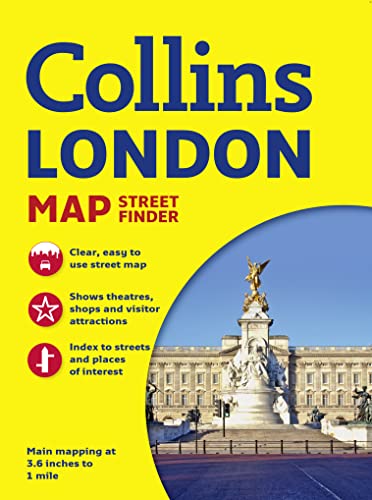
New editionScale: 1:17,500 (3.6 inches to 1 mile)Full colour street level map of a large area of central London, bound in an attractive card cover. Ideal for tourists.MAIN FEATURESThis attractive tourist map, presented in a durable card cover, has clear full colour mapping at 3.6 inches to 1 mile. It has a wealth of detail, showing colour-coded land use information in addition to the intricate named street network. Key destinations are plotted and named on the map and all the streets and places of interest are fully indexed.INCLUDESMain railway lines and stationsFull colour-coded detailUnderground map on the back coverUnderground stations plotted on mapSeparate index for places of interestAREA OF COVERAGEFrom Hammersmith in the west to the Isle of Dogs in the east and from Hampstead in the north to Clapham in the south.WHO THE PRODUCT IS OF INTEREST TOIdeal for the tourist or visitor who wants a bit more that just central London.
Price history chart & currency exchange rate
Customers also viewed

$6.05
Paire de Manches de Mariée Longues et Élégantes - Polyester Transparent avec Poignets à Volants, Ajustement Élastique pour Robes & Robes, Idéal pour , Banquets, Fêtes & Photographie
temu.com
$29.69
2pcs Men's Tactical Hiking Pants - Lightweight, Polyester Cargo Trousers With Multiple Pockets, Ideal For &, Machine Washable, In Dark Green & Gray, Camping Gear
temu.com


/velikii-zhinochii-gamanets-guess-swgb89-87630-sto-0190231756668.jpg "Великий жіночий гаманець Guess SWGB89 87630 STO, Écru")


$4.89
Solid Color Checkered Phone Case for IPhone11 12 13 Pro Max X XR 7 8 Plus SE Cover Transparent IPhone Case Fall Protection Shell
aliexpress.com
$3.92
Dog Recovery Sleeve Pet Wounds Extra Supportive Dog Canine Rear Leg Hock Joint Wrap Protects Bandage Puppy Protect
aliexpress.com
$1.12
2pcs Car Anti-collision Door Corner Cover Silicone Protective Sticker for Seat Leon Ibiza Cover Leon Mk2 3 Ibiza 6l Accessories
aliexpress.com
$1.31
1pcs Car Logo Fuel Tank Cover Decoration Sticker for INFINITI Ex35 M35 Q50 Q30 Carplay G37 Qx70 Q60 Qx30 Q50 Car Accessories
aliexpress.com
$1.89
Car Audio Video Speaker Emblem Aluminum Stickers Decoration For Peugeot 206 207 306 307 408 Auto Interior Accessories Styling
aliexpress.com
$34.81
portable wireless bluetooth speaker casual appearance stereo soundbar wireless bluetooth audio player 4color available
dhgate.com
$22.60
Дитячий набір шість предметів Дитячий назальний інгалятор, ножиці для нігтів, щітка, пилочка, гребінець, набір аксесуарів для щоденного чищення та догляду для сірий
joom.com
$11.29
Миниатюрный камин ручной работы из дерева для декора миниатюрных домиков, очаровательный аксессуар для кукольного домика, детализированная миниатюра в масштабе 1:12
aliexpress.ru
$23.88
Простой хлопковый балдахин для кровати, цельный, для односпальных и двуспальных кроватей, для дома и общежития, всесезонный, универсальный, на резинке
aliexpress.ru
$18.35
Корейский вязаный кардиган с длинными рукавами, осенне-зимний, приталенный, с узором косы, высококачественный трикотажный верх
aliexpress.ru
$4.00
ПВХ Арахіс Форма Масаж Йога Фітнес М яч Stress Relax Тіло Spiky Massager рожевий червоний колір
joom.com
$5.69
Маленькие цифровые термометры для ванны с быстрым датчиком и автоматическим включением и выключением, точные термометры для воды
aliexpress.ru
$19.29
Модная повседневная женская зимняя теплая куртка больших размеров, флисовая куртка, шерстяная длинная верхняя одежда с капюшоном 2026
aliexpress.ru, кронштейн-держатель для радиостанции, сменный аксессуар для кемпинга/походов на природе")
$13.96
Крепление-карабин для рации (1 шт.), кронштейн-держатель для радиостанции, сменный аксессуар для кемпинга/походов на природе
aliexpress.ru
$140.45
Перезаряжаемое устройство для терапии сна - двойная функция TENS и CES для лечения бессонницы, тревоги, депрессии, с LED-дисплеем
aliexpress.ru
$15.77
Почтовый ящик A12E-Post, антикварный металлический почтовый ящик, устойчивый к ржавчине, подходит для улицы, белый цвет
aliexpress.ru
$9.50
Чип для сброса тонера для Toshiba e-Studio eStudio e Studio T FC616DK T FC616DC T FC616DM T FC616DY T FC616E-K T FC616E-C T FC616E-M
aliexpress.ru
$35.48
Легендарная модель пиратского корабля Black Sail из строительных блоков, музейного качества, трехмачтовый парусник с подставкой для демонстрации
aliexpress.ru
$50.87
Ковбойская цепь в стиле рок, уличный стиль, 8 мм, с шариками, для ключей, кошелька, ремня, для мужчин и женщин, модный подарок в стиле хип-хоп
aliexpress.ru
$598.00
Велосипед TWITTER R10pro RS-2*11S с полностью скрытыми тросами, аэродинамичным дизайном, карбоновой рамой 43,5 см/56 см, гидравлическими дисковыми тормозами.
aliexpress.ru
$21.92
Креативні Принти Черепахи, Що Пливуть, Жіночий Одяг Худі Спортивні Топи Зручний Спортивний Одяг Модний Одяг L
joom.com
$7.41
For Haval 4/8Pcs Aluminum Car Tire Wheel Stem Air Valve Cap Auto Accessories H5 H7 H8 H9 M4 M6 F5 F9 F7X F7H H2S Jolion Great
joom.com
$4.59
Korean Style Cartoon Plush Headband Giraffe Ears Face Washing Hair Hoop Girls/Female коричневий
joom.com
$5.81
Fashion Printed Cat Dog Collar Colorful Paw Pattern With Bell Adjustable Safety Neck Collar Pet Supplies рожевий червоний колір
joom.com
$16.95
Portable Dopamine Color Pencil Case Multi-functional Large-capacity Pen Bag Stationery Pouch School Supplies синій
joom.com
$7.05
Women Valentine s Day Gifts Retro Open Ring Unisex Adjustable Toad Bohemian Creative Animal Frog Rings срібний
joom.com
